Cambridge Intelligence weaves fresh magic with milestone tech
The company's developer toolkits are said to make it easy to build powerful, customised user experiences for complex data. MapWeave lets developers build market-leading apps that integrate map, network, timeline and observations data into an intuitive investigative workflow.
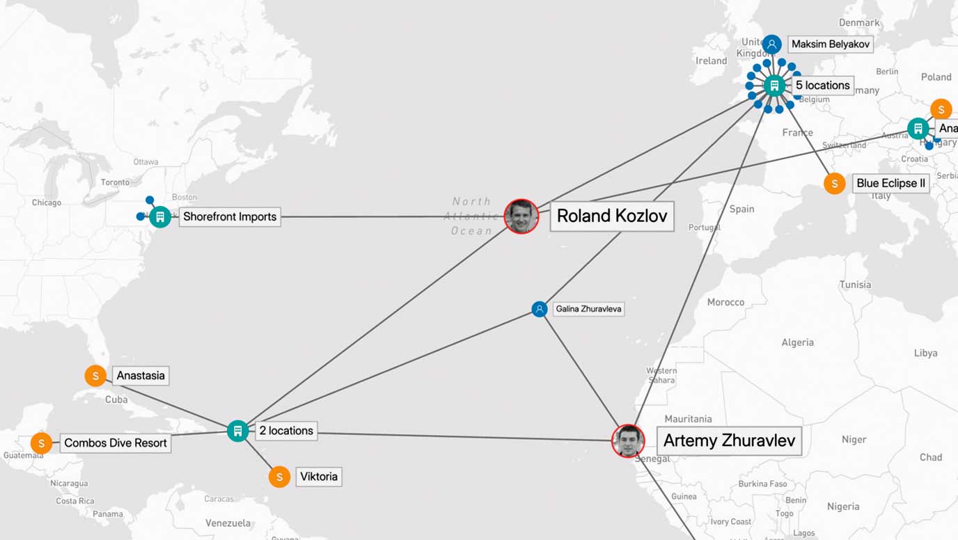
For teams working with complex geospatial intelligence, it’s a game-changer – uncovering connections and patterns that were previously hidden across huge, fragmented datasets and tools.
MapWeave integrates map, network, timeline and observations data into a unified, intuitive interface - empowering teams to build next-level solutions for complex geospatial intelligence challenges.
With a pluggable architecture, scalable rendering, and a rich set of built-in tools, MapWeave makes it easy to integrate geospatial analysis into any intelligence application.
Dan Williams, Chief Product Officer at Cambridge Intelligence said: “MapWeave brings a level of clarity to geospatial investigations that simply hasn’t been available to our customers before. It helps organisations in security, fraud detection, and intelligence get more from their data - faster, and with fewer barriers.”
Traditional GIS tools show where things happen - but not why. Cambridge Intelligence says MapWeave closes that gap, offering a purpose-built approach to understanding how people, objects, and events connect across time and space.
Whether tracking vehicle movements, identifying fraud rings, or mapping cyber threats, MapWeave helps users uncover hidden relationships that would otherwise remain buried in fragmented data systems.
Since launching its Early Access Program, Cambridge Intelligence has worked closely with users in multiple sectors to refine MapWeave for enterprise-ready deployments. The result, they say, is ‘a robust, flexible SDK that enhances any investigation platform by bringing physical and digital data together in a single investigative view’.
Key features of MapWeave include: Real-time performance across millions of data points; Trajectory and movement analysis over time; Smart clustering and edge bundling for clear visual storytelling; Smooth integration with Cambridge Intelligence’s KeyLines and KronoGraph SDKs; and extensive documentation and demos to support fast development.
For a a free trial, visit: https://cambridge-intelligence.com/mapweave/try/